-
Services
- Property and urban development
- Project and construction management
- Architectural design
-
Structural engineering
- Structural and element engineering
- Wood structures
- Residential and hybrid buildings
- Hotels and other accommodation
- Schools, educational institutes and day care centres
- Cultural facilities
- Business and office premises
- Fire engineering
- Parking facilities and terminals
- Hospitals and healthcare facilities
- Technical analysis FEM and CFD
- Industrial structural engineering
- Research and development
- Sports and recreation facilities
-
Industrial engineering
- Energy engineering
- Energy audit
- Energy and HVAC measurements
- Project and construction management
- Refrigreration engineering
- Fire engineering
- Process engineering
- Cleanroom engineering
- Emission measurements
- Electrical Engineering
- Technical analysis FEM and CFD
- Industrial HVAC engineering
- Safety engineering
- Process automation
- Industrial structural engineering
- Research and development
- Environmental impact assessment
- Renovation engineering
- Infrastructure engineering
- Geotechnical engineering
- Rock and underground engineering
- Building services engineering
- Energy engineering and consulting
- Acoustical engineering
- Cost and sustainability management
-
Low-carbon construction and circular economy
- Energy consulting
- Environmental Product Declaration EPD
- Carbon footprint consulting
- Carbon footprint calculation
- Carbon-neutral urban development
- Circular economy consulting
- Construction and demolition waste compliance
- Pre-demolition audit
- Optimisation of the carbon footprint of materials
- Groundworks with recovered materials
- Low-carbon construction management
- Environmental services
- Surveys and inspections
- Specialist services
- References
- News
- About us
- Contact us
- Home
- News
- Using satellite data to analyse the correlation between housing prices and nearby green areas

Using satellite data to analyse the correlation between housing prices and nearby green areas
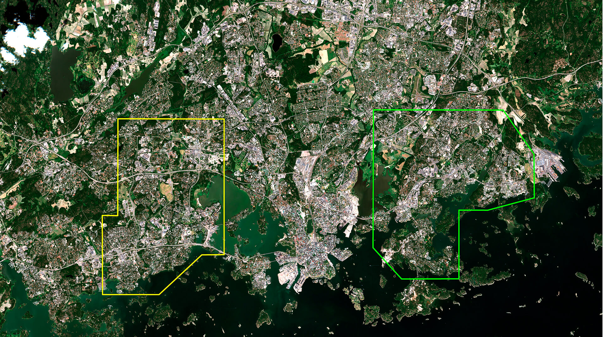
AINS Group is investigating the impact of nearby green areas on the attractiveness of urban areas and on housing prices. The objective is to be able to utilise findings from the project, based on satellite data, in city planning and for predicting real-estate prices. Acting as a research partner in the project is VTT Technical Research Centre of Finland.
Launched earlier this year, the project is receiving funding from the European Space Agency (ESA). The principle involves analysing the connection between urban green areas– such as parks, fields of grass, woods, and seaside land – and housing prices on the basis of data transmitted by ESA satellites.
– The COVID-19 situation has shifted the focus to the importance of parks and nature as a resource for residents. In general, very little is known about how important the proximity of nature is in purchase decisions and for areas’ attractiveness, says the project manager, AINS Group’s Director of Urban Development Jukka Kettunen.
As AINS Group’s partner in the research, VTT aims to uncover possible correlations of the proximity of various nature and park areas with prices of housing by analysing satellite data. Research of this type has not been done in Finland before.
– International investigations indicate that such a correlation exists. For instance, studies done in London have shown how much fruit investments in parks have yielded in terms of improved public health and higher residential property values, says Kettunen.
Could green areas be an attraction factor?
The AINS Group’s analysis is a so-called feasibility study that is aimed at identifying the possible benefits of data transmitted by the ESA satellites in city planning and development. The City of Helsinki and the City of Espoo are participating in the project as partners.
There is a simultaneous objective of developing the AINS Group Cityfier modelling tool, which analyses the plan pool and predicts the development of property values in various residential areas. At the moment, value-development modelling is carried out on the basis of the proximity of existing and planned flats, office buildings, traffic connections, and services.
– We will find out how the appreciation of nature is reflected in prices. Should we consider green areas to be a profitable investment and attraction factor that should be the first thing created in work to build new residential areas? Also, it will be interesting to see how much the COVID-19 situation is going to affect the appreciation of flats and home sales, says Kettunen.
Results from the research project should be available in the autumn.
For further information:
Jukka Kettunen, Director of Urban Development for AINS Group
Tel. +358 40 733 8280
jukka.kettunen@ains.fi
Learn more about Cifyfier at cityfier.com
PICTURE: Copernicus Sentinel data from 2018, ESA

